Milk Street Better Bike Lanes
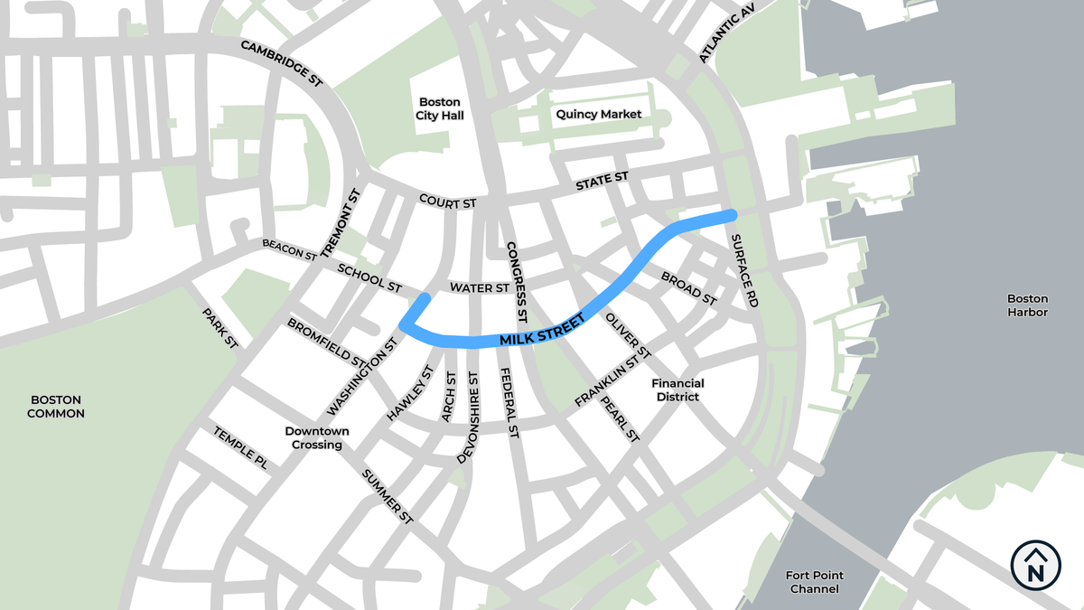
We will add safe, comfortable bike lanes on Milk Street to create connections from our Tremont Street bike lanes to the Financial District and the Greenway.
Talk with us
EventsWhy Milk Street
Downtown Boston and the Financial District hold some of the highest concentration of jobs in the region. There are also historic landmarks, as well as dining and retail destinations. Milk Street will serve as the eastbound pair to westbound bike lanes on State Street and Court Street.
Everyone in Boston deserves safe streets

This project is part of a bold plan for transforming Boston's streets to better serve people walking, rolling, and riding bikes. Over the next three years, we will expand our bike network so that 50% of residents will be a 3-minute walk from a safe and connected bike route.
The project area includes Milk Street between Washington Street and Surface Road. It also includes a short section of Washington Street between Milk Street and School Street.
Our Vision for Milk Street
Accessible curb ramps. We will rebuild curb ramps that do not meet accessibility standards.
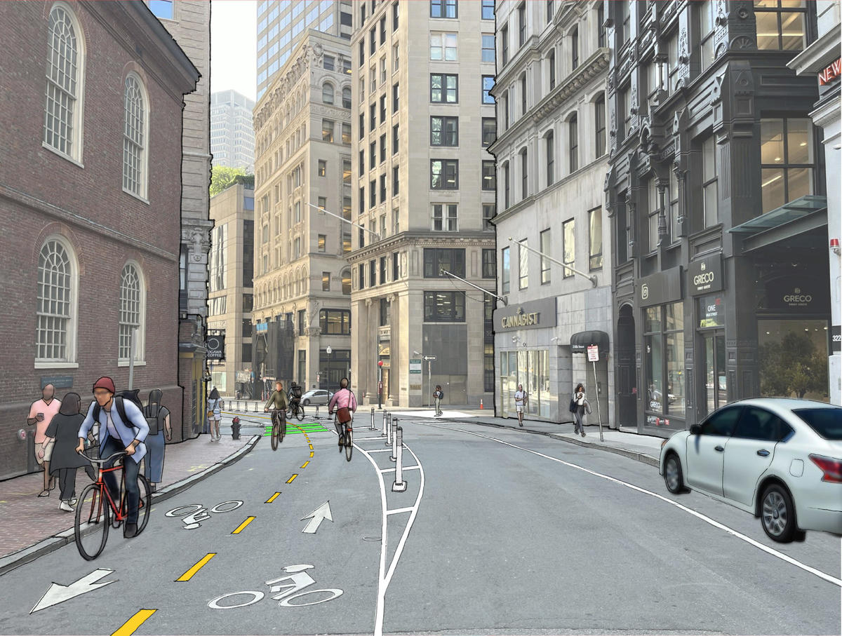
A "soft" expansion of the downtown pedestrian zone. Changes to traffic circulation on Milk Street would greatly reduce the number of motor vehicles on Milk Street between Hawley Street and Washington Street and on Washington Street between Milk Street and School Street. Fewer motor vehicles would improve the experience for people walking. We would make Milk Street one-way eastbound from Washington Street to Devonshire Street. These changes would also make more space for people biking, for commercial loading, and for pick-up/drop-off activity.
Dedicated, protected space for people biking. On Milk Street from Washington Street to Devonshire Street, people will be able to bike in both directions. From Devonshire Street to Surface Road, biking will be one-way eastbound only (towards the waterfront). On Washington Street between School Street and Milk Street, people will be able to bike in both directions.
Clear, legal zones for commercial loading and pick-up/drop-off traffic. Today, these activities often happen where they are not allowed. We will work with local businesses to understand their curb access needs and create new areas for short-term parking and loading.
Updates
UpdatesWe are letting you know about the project and how to get involved. In December 2022, we are going door-to-door to speak with ground-floor businesses on Milk Street. We are also sending a postcard to about 2,000 addresses on and near Milk Street. The postcards will arrive in later December 2022 or early January 2023.


