Update on the Ronan Park Well
City Archaeologist Joe Bagley is providing updated historical research on the historic well site.
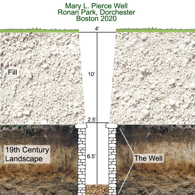
City Archaeologist Joe Bagley, with the help of long-time Archaeology Program volunteer, Amy Ohman, has completed a report on the Mary L. Pierce Well, discovered in December in Dorchester’s Ronan Park. The hole formed when the cover to an old well from the 1800s failed, opening a hole at the surface. The well was two feet wide and made from stacked cobbles capped with granite slabs. When active, it would have been over 25 feet deep. The hole has since been refilled by the Parks and Recreation Department and is safe for all residents.
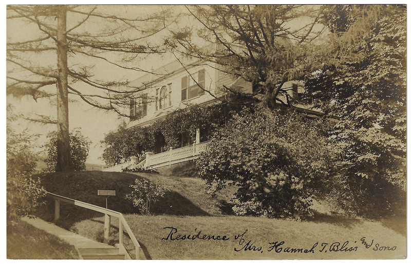
The well was part of the property at 151 Adams Street, also known as the Pierce-Bliss House. The property was originally part of traditional homelands of the Massachusett Tribe. In the 17th and 18th century, the area remained undeveloped pasture and farmland.
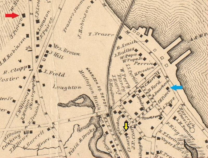
In 1818, John Pierce, a bricklayer, purchased 10 acres of land on the west side of Adams Street, and soon after built a brick house for he and his wife, Mary, and their son, Charles Bates Pierce. John also had a second house built just to the north, which would be the Pierce-Bliss house.
Charles B. Pierce married Mary Emery of Springfield, MA, in 1846. They lived together in Dorchester near 300 Freeport Street, across from where Yale Appliance is located today. Mary and Charles B. Pierce had two children, Elizabeth Emery Pierce (1847) and Charles Bates Jr. (1851).
Sadly, Charles Sr. died from Typhoid Fever in 1857. At that time, a series of unfortunate events befall Mary. Without a will, Mary took on the administration of her husband’s real estate and personal possessions, selling over $43,000 worth of land and buildings in 1857, including their own home. In 1865, and despite there being numerous relatively wealthy family members nearby, Mary, Charles, and Lizzy (Elizabeth) appeared in a boarding house or tenement just south of Fields Corner, at the intersection of Dorchester Avenue and Parkman Street.
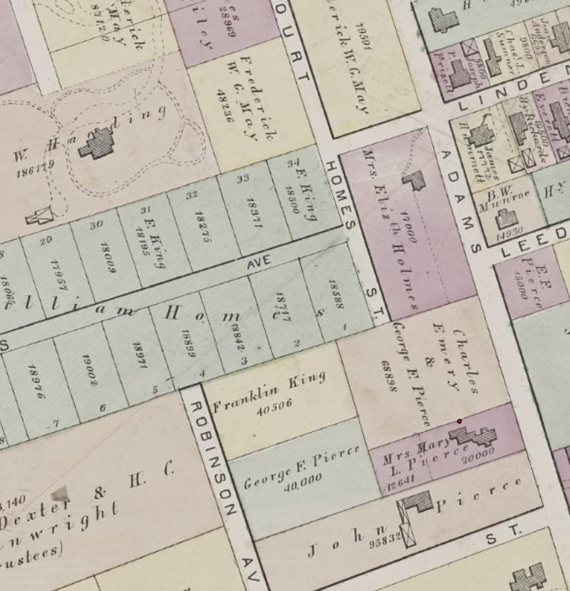
We do not know just how long Mary and her children stayed in the boarding house. In 1871, her father-in-law John Pierce died, leaving part of his estate, including the home at 151 Adams Street, to his grandchildren Charles and Elizabeth. Mary bought the house at auction from her own children and family in 1871.
Mary’s Brother, Charles Emery, and her brother in-law- George F. Pierce, purchased the abutting portion of John Pierce’s estate just north of Mary’s house and land.
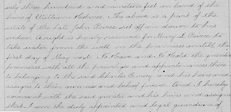
Shockingly, both Mary and Charles’ deeds state that Mary must be allowed access to a well on Charles’ land between the date of the sale (September 22, 1871) until May 1, 1872. The location of the Ronan Park well is so close to the boundary between Charles and Mary’s land, that it could be the very same well!
Given the well’s location, it is either a well built behind the house in the early 1800s and abandoned when Mary dug her own well by May 1, 1872, or it is the new well dug between September 1871 and May 1872 to replace the one now on a different property. Either way, it was likely abandoned no later than the 1880s when running water reached this area of Adams Street and it was no longer needed.
On November 30, 1885 Mary L. Pierce died from cancer, leaving the bulk of her estate and home to her daughter Elizabeth, to her maid Catherine, and her nurse Mary Ronan.
Just seven years later in 1892, Elizabeth died. She followed her mother’s lead, leaving the vast majority of her estate to 20 women important in her life, including the house at 151 Adams Street to her cousins, Mary and Anna Patterson.
The house was sold for $1 to Hannah T. Bliss, but after she died in 1910, the property was sold to the City of Boston in 1912 to build Ronan Park.
Despite its large size, only two buildings were demolished in order to create the park, including the Pierce-Bliss House. During the landscaping of the park, large quantities of dirt were brought in to help transition the topography from the low Adams street level to the upper ball field, requiring 10 feet of dirt to be added to the former back and side yard of Mary Pierce, where the old well once lay.
Though perhaps not the most significant archaeological discovery ever made in Boston, this hole in a Dorchester park has given us a chance to bring to mind forgotten neighbors from the days of auld lang syne.
Happy New Year!

