Construction completed of key Healthy Streets projects
New bus lanes, walk-friendly signal changes, and separated bike lanes have been added in Downtown, Mattapan, and Roslindale.
Mayor Martin J. Walsh today announced the completion of several Healthy Streets projects in Downtown, Mattapan, and Roslindale, to support transportation safety and reliability. These projects originate in Go Boston 2030, the City's long-term transportation action plan, and were accelerated during the COVID-19 pandemic. Mayor Walsh announced these projects earlier this fall as part of the second phase of the Healthy Streets transformation.
"The Healthy Streets initiative outlines our goals to support a safe, reopening and equitable recovery in Boston, and I'm pleased to see substantial progress made on these important projects," said Mayor Walsh. "Safe and reliable transportation, especially for our essential workers and commuters, is one of our top priorities as we respond to the COVID-19 pandemic."
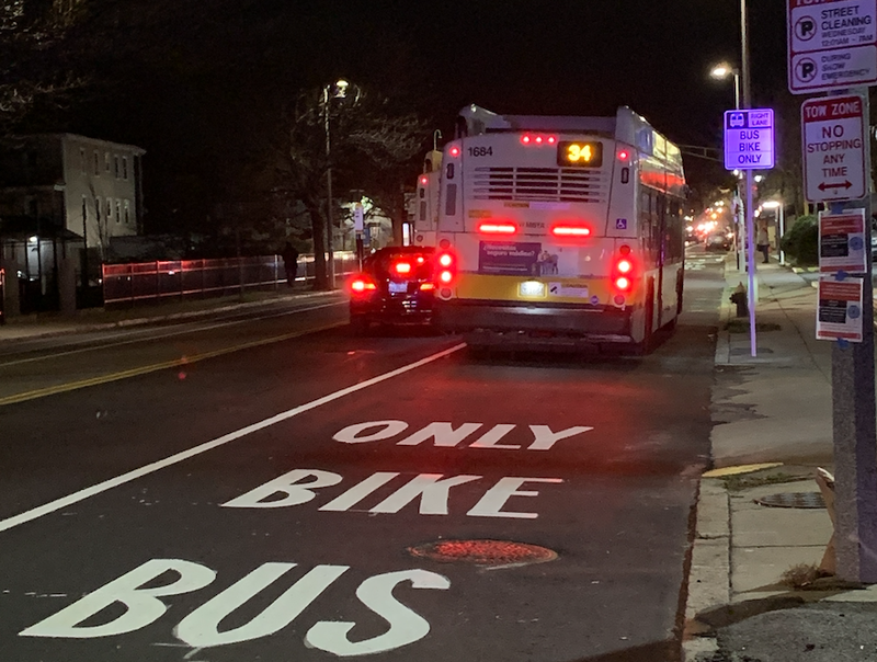
The City of Boston, in partnership with the Massachusetts Bay Transportation Authority (MBTA), has added a new bus lane on Washington Street in Roslindale for the evening peak hours. The new lane serves riders on ten bus lines traveling from Forest Hills station to Roslindale Village. Bus priority on this stretch of Washington Street was identified as an early action item in Go Boston 2030.
"The Mayor's Healthy Streets initiative has been an important program to help residents travel safely during the COVID-19 pandemic and advance the long term goals that our residents prioritized in Go Boston 2030," said Chief of Streets Chris Osgood. "We appreciate the collaboration with neighborhood groups on the design and installation of the new bus lanes, the pop up bike lanes, and the calmed streets, and we welcome their continued feedback."
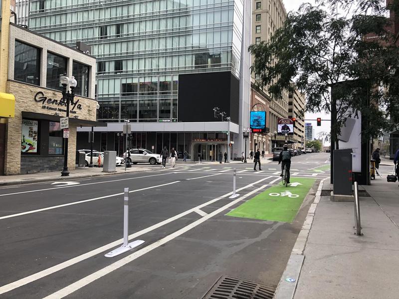
The City has also completed implementation of the first phase of the Connect Downtown project. This project, along with the State Street redesign pilot now in place, are the result of a year of community input and feedback. Overall, both projects make more room for walking and create a connected bike network. In addition, many Walk signals were adjusted to provide safer and more frequent crossing opportunities for people on foot or with mobility devices. The City made changes to the street layout and to traffic signals on many streets in the downtown core: State Street (Atlantic to Congress), Court Street (Court Square to Tremont), Tremont Street (Court to Shawmut), Boylston Street (Arlington to Washington), Charles Street (Boylston to Beacon Street), Beacon Street (Charles to Arlington), and Arlington (Beacon to Boylston). Detailed information about these changes can be found online: boston.gov/connect-downtown#design-changes.
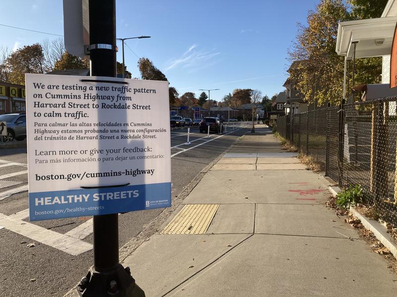
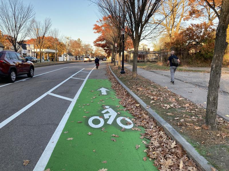
As a result of vehicular speeds increasing during the pandemic, the City's Public Works and Transportation Departments acted quickly to test and refine a design that slows speeds to safe levels on Cummins Highway in Mattapan. Data collected through the summer indicated that the safer speeds have been accompanied by only minor additional congestion. Cummins Highway was identified in Go Boston 2030 for improved sidewalks, transit access, greenery, and bike connections. Community feedback will inform our coming full reconstruction of the street between Wood Avenue and Mattapan Square.
With support from many neighbors in Roslindale and Dorchester, the City has made significant progress in calming traffic on American Legion. The redesigned street is more comfortable for walking, crossing the street, and riding bikes with family members. Through the end of the year, the City will continue its work by modifying Walk signals and installing modular curbs and posts to define the new bike lane. Together with the separated bike lanes added to Cummins, the bike lanes on American Legion provide a family-friendly route between the Neponset Greenway and Franklin Park. People can continue through Franklin Park's Circuit Drive to access bike paths on the Arborway and along the Southwest Corridor. Resident feedback will guide the next phase of changes on American Legion, expected to be designed in 2021.
Mayor Walsh announced the Healthy Streets initiative in late May 2020 to support a healthy, safe, and equitable recovery from the COVID-19 pandemic. The first phase of Healthy Streets included an expanded outdoor seating program to support restaurants, expanded bus stops to provide more space at busy locations, implementation of a planned bus-priority lane on Washington Street in Chinatown to improve reliability of commutes on the Silver Line, and several miles of "pop-up" bike lanes created with cones, barrels, and water-filled barriers that provided more space for physically-distanced activity and connections to jobs. In September, Mayor Walsh announced the construction of new bus lanes and approximately seven miles of new separated bike lanes.
These changes to City streets improve safety and keep drivers' speeds in check, as well as provide safe and reliable commutes for those commuting by bike or bus. More space to walk and to bike help our residents improve their mental and physical well-being during a trying year.
Today's transit investments echo Mayor Walsh's advocacy against the recent cutbacks announced by the MBTA, and build on the City's ongoing work to protect the health, equity, and future of Boston's communities and to support a healthy reopening and an equitable recovery in light of the COVID-19 pandemic.
About Go Boston 2030Go Boston 2030 is the City of Boston's long term mobility plan, informed by thousands of residents during a two-year engagement process. Go Boston 2030 envisions a city in a region where all residents have better and more equitable travel choices, where efficient transportation networks foster economic opportunity, and where steps have been taken to prepare for climate change. Whether traveling by transit, on foot, on a bike, or by car, people will be able to access all parts of Boston safely and reliably. To learn more visit boston.gov/go-boston-2030


