Berkeley Street Bike Lanes
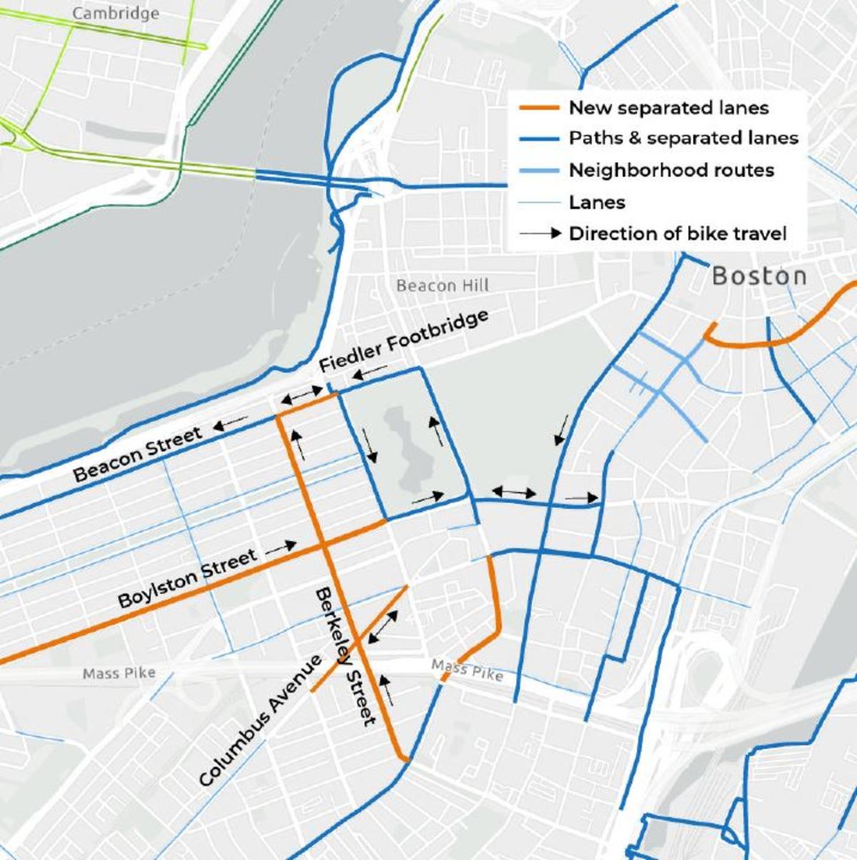
We're adding separated bike lanes on Berkeley Street and Beacon Street to connect the South End to the Back Bay and to bring people from both neighborhoods to the Esplanade.
The new lanes are part of an expansion to close gaps in Boston’s low-stress bike network. Today, people who want to bike from the South End to the Back Bay don’t have great options. The new lanes will allow for a continuous, comfortable ride from the South End to the Back Bay and provide access to the Charles River via the Arthur Fiedler Footbridge.
Talk with us
Talk with usWHY BERKELEY STREET
- Berkeley Street is the only street that connects South Boston to the Back Bay—a major employment center and commercial destination.
- We can add a separated bike lane to Berkeley Street while keeping vehicles flowing as well as they do today. In general, two general lanes can accommodate vehicle traffic south of Boylston Street; we are adding turn lanes in some places to improve safety. North of Berkeley Street, we plan keep the same number of lanes. Here, the separated bike lane replaces the parking lane. We cannot add a separated bike lane to other streets without restricting the flow of traffic, changing street directions, and/or removing on-street parking.
- Despite less-than-ideal bike conditions, we've counted between 200 and 300 people riding on Berkeley Street on weekdays—and that doesn't include people riding on the sidewalks.
- There is a history of bike crashes on Berkeley Street that resulted in serious injuries requiring a public safety response. Boston has committed to focusing the City's resources on proven strategies to eliminate fatal and serious injury traffic crashes by 2030.
- Berkeley Street connects two vibrant shopping, dining, and entertainment districts: Tremont Street in the South End, and Newbury Street in the Back Bay.
- The new bike lane on Berkeley will bring riders to the Charles River Esplanade, by way of a new, two-way bike lane on Beacon Street and the Arthur Fiedler Footbridge.
Everyone in Boston deserves safe streets
The Berkeley Street project is part of a bold plan for transforming Boston's streets to better serve people walking, rolling, and riding bikes. Over the next three years, we will expand our bike network so that 50% of residents will be a 3-minute walk from a safe and connected bike route.
Concept Design
We have illustrated the design concept for Berkeley Street from Tremont Street to Beacon Street.
Design details
TREMONT STREET TO BOYLSTON STREET
- We're adding a bike lane going northbound (towards Beacon Street) to the east side of the street.
- We're keeping two travel lanes for motor vehicles—sufficient capacity for the volume of vehicles in this section of Berkeley.
- We're keeping parking on both sides of the street—against the western curb and also along the bike lane, separated by a striped buffer with flexible delineators.
- There will be a bus lane between Columbus Avenue and St. James Avenue—the stretch where bus riders experience the greatest delay.
BOYLSTON STREET TO BEACON STREET
- The bike lane continues northbound (towards Beacon Street) to the east side of the street. Cyclists will cross Beacon on the green light. Those heading westbound on Beacon Street (towards Massachusetts Avenue) will press the button and wait for the walk signal to cross.
- There will be two travel lanes for motor vehicles—the same as today. We are also keeping all existing turn lanes.
- There will be parking on one side of the street along most of the corridor:
- Between Boylston Street and Commonwealth Avenue, the parking will be on east side of the street—along the bike lane, separated by a striped buffer with flexible delineators.
- Between Commonwealth Avenue and Beacon Street, the parking will shift to the west side of the street—against the curb.
BEACON STREET FROM BERKELEY STREET TO ARLINGTON STREET
- We're adding a two-way bike lane along the north side of Beacon Street. People biking to the Esplanade will dismount at the Storrow Drive off-ramp and then use the walk signal to cross both the off-ramp and David G. Mugar Way, before walking their bikes over the Arthur Fiedler Footbridge.
- We're keeping three travel lanes for motor vehicles (one will remain a right turn lane.)
- We're keeping parking on the south side of the street.
COLUMBUS AVENUE FROM CLARENDON STREET TO ARLINGTON STREET
- We're adding parking-protected bike lanes in both directions of travel. Designs are in progress.
Common Questions
Common QuestionsBerkeley Street is also an important connection for drivers accessing Storrow Drive, as well as emergency vehicles serving the neighborhood. We are retaining all of the existing motor vehicle travel lanes and turn lanes north of Boylston Street. South of Boylston Street, we're keeping two motor vehicle travel lanes—sufficient capacity for the volume of vehicles in this section of Berkeley. We are also working with traffic signal engineers to make adjustments to signals that could improve the flow of vehicles along Berkeley Street.
We always preserve as much parking as we can while keeping all travelers moving and safe. Below is a summary of how we're providing for parking access.
We're working with abutters to redesign curb regulations so that they best balance the needs of residents and businesses, including short term parking and pick-up/drop-off, resident permit parking, and loading.
Additionally, we have a separate plan to replace some meter spaces in the Back Bay, north of Commonwealth Avenue, to increase resident parking and create needed pick-up/drop-off loading zones, while maintain meters near retail shops.
TREMONET STREET TO BOYLSTON STREET
- We're keeping parking on both sides of the street—against the western curb and also along the bike lane, separated by a striped buffer with flexible delineators.
BOYLSTON STREET TO BEACON STREET
- There will be parking on one side of the street along most of the corridor:
- Between Boylston Street and Commonwealth Avenue, the parking will be on east side of the street—along the bike lane, separated by a striped buffer with flexible delineators.
- Between Commonwealth Avenue and Beacon Street, the parking will shift to the west side of the street—against the curb.
BEACON STREET FROM BERKELEY STREET TO ARLINGTON STREET
- We're keeping parking on the south side of the street.
COLUMBUS AVENUE FROM CLARENDON STREET TO ARLINGTON STREET
- While there will be some change to the number of parking spaces on Columbus Avenue, most of the parking will remain.
Bicyclists reaching the northern end of Berkeley Street will soon be able to take a right on a new bike lane we are planning on the block of Beacon Street between Berkeley and Arlington Street. This facility will allow access to the Esplanade via a short walk over the Arthur Fieldler footbridge.
We are also designing a two-stage turn box for bicyclists who wish to turn left from Berkeley onto the existing westbound Beacon Street bike lane. After crossing Beacon on the green light, cyclists will push a button and wait for the bike signal to indicate that all conflicting movements are turned off and it is safe to cross Berkeley Street. The turn box will be outside the path of vehicles heading straight on Berkeley as well as vehicles turning right from Beacon towards the Storrow Drive on-ramps.
We expect construction to begin this summer. You can also sign up for email updates using the form above.
Past Updates
UpdatesWe hosted a series of in-person, outdoor events to meet with neighbors and passersby.
- Tuesday, May 23, 5-7 p.m. at the intersection of Berkeley Street and Tremont Street
- Wednesday, May 24, noon - 2 pm. at the intersection of Boylston Street and Berkeley Street
- Thursday, May 25, 8-10 a.m. at the intersection of Boylston Street and Gloucester Street
- Saturday, May 27, 2-4 p.m. at the intersection of Berkeley Street and Commonwealth Avenue
In February 2023, we announced the project to residents and users of the corridor. We mailed postcards to almost 5,000 households on Berkeley and adjacent blocks. Later in February, we posted flyers on light poles, bikes, and cars on Berkeley Street between Tremont Street and Beacon Street. We also stopped into businesses to share flyers and send an email to the project mailing list.
- We hosted virtual office hours every other Wednesday. You shared your feedback on Better Bike Lanes projects. We also corresponded with you via email.
- We began planning for spring and summer 2023 outreach and community conversations.
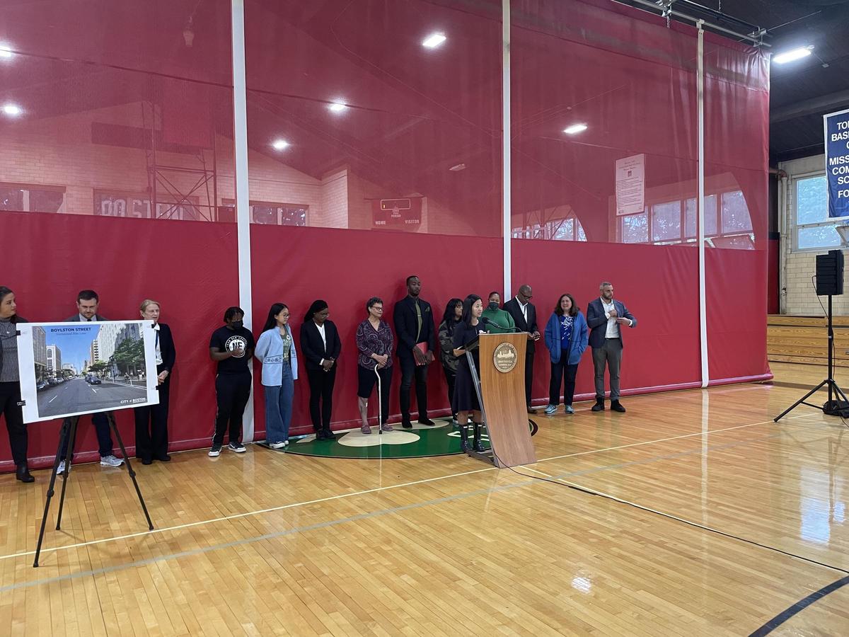
To build on her commitment to create safe streets for all modes of transportation, Mayor Michelle Wu and the Boston Transportation Department (BTD) announced a 9.4 mile expansion of bike lanes providing key connections within the City’s existing bike network. To do this, Boston is expanding Bluebikes to accommodate rising demand, designing traffic-calmed streets by building speed humps and raised crosswalks, and hiring more staff to aid in the design process.
The announcement was covered by local news outlets.


